
Weather Alerts for Otoe Co.Issued by the National Weather Service |
| No severe weather expected for Otoe Co. |
Navigation
Alerts
Mobile Weather
Get SE LincolnWx SmartPhone Weather
 Scan With Phone's Bar Code Reader
US Weather Extremes
| ========== |
| USA |
| High Temp |
| 99°F at Castroville Muni Tx, TX |
| Low Temp |
| 7°F at Rolla Municipal Airport, ND |
| Precipitation |
| 3.21in at Blue Canyon Nyack Ap, CA |
| ========== |
NE Weather Extremes
| ========== |
| NE |
| for
Wednesday, April 1, 2026 |
| High Temp |
| 53°F at Scottsbluff W B Heilig Field Ap, NE |
| Low Temp |
| 26°F at Wayne Municipal Ap, NE |
| Precipitation |
| 0.53in at Columbus, NE |
| ========== |
| Data from NWS CPC |
External Links
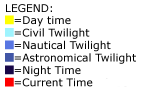
Local Sunlight Hours
| (Noon) |

|
| (Midnight) |
Style Options
Weather Alerts for Otoe Co.Issued by the National Weather Service |
| No severe weather expected for Otoe Co. |

 
|